So many things!
OpenCities Planner is continuously updated, and in case you’ve missed the updates – here’s a quick recap of the most important things released over the last few months.
So many things!
OpenCities Planner is continuously updated, and in case you’ve missed the updates – here’s a quick recap of the most important things released over the last few months.
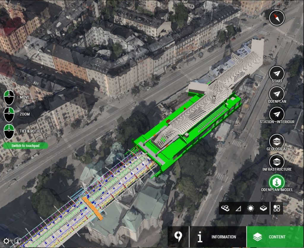
Users with Premium Instance subscription can now import DGN, DWG, Revit, IFC and more with full fidelity into OpenCities Planner! Geometry and attributes are maintained from the original design file.
The workflow is using the Bentley iModelHub, which is an intelligent cloud storage for your design files. Single or multiple files are synchronized into a container, called an iModel. OpenCities Planner supports adding multiple iModels to the same project and is capable of visualizing them simultaneously, just like any other object in your project.
The attributes from your BIM files can be displayed on click on an element, and you can even reference attributes and use to fetch related data from a REST service for instance.
Note: Viewing iModels is only for invited team members
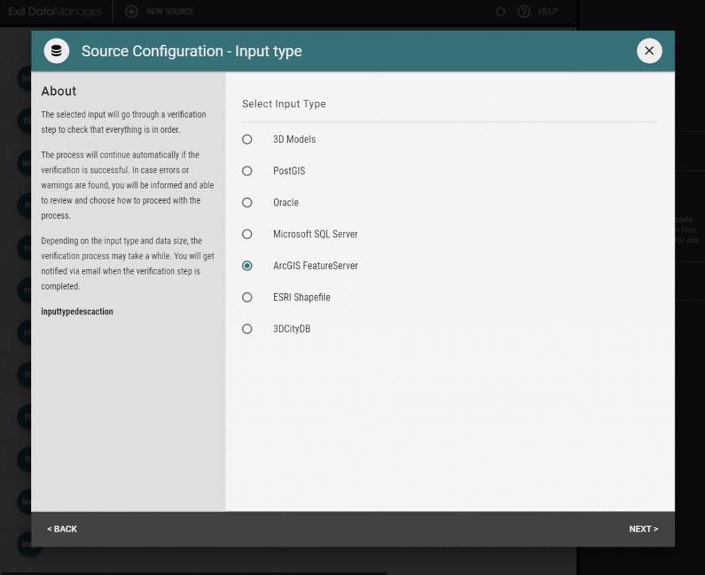
New feature Sources
DataManager now supports Microsoft SQL database and ESRI ArcGIS FeatureServer as feature sources. The workflow is the same as any other feature source, you configure the source and then you can do simple styling with settings and advanced styling with javascripting.
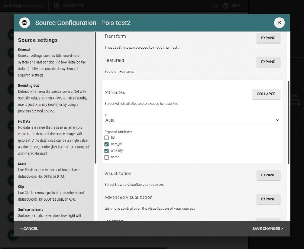
Attributes configuration
Attributes from features sources can be configured to display on an onClick action by the user. You can also reference attributes in for instance a Details window by using the syntax ${attributes.attributename} (replace attributename with your actual name of the attribute you want to display).
Custom images for POI and projected image styling
When styling feature data as Points of interest or projected image on terrain, you can now use images available in the icon library. You can also add your own images to the icon library.
Check out the scripting reference to understand how to create generalized 3D models, or points of interests, or extruded volumes based on your features.
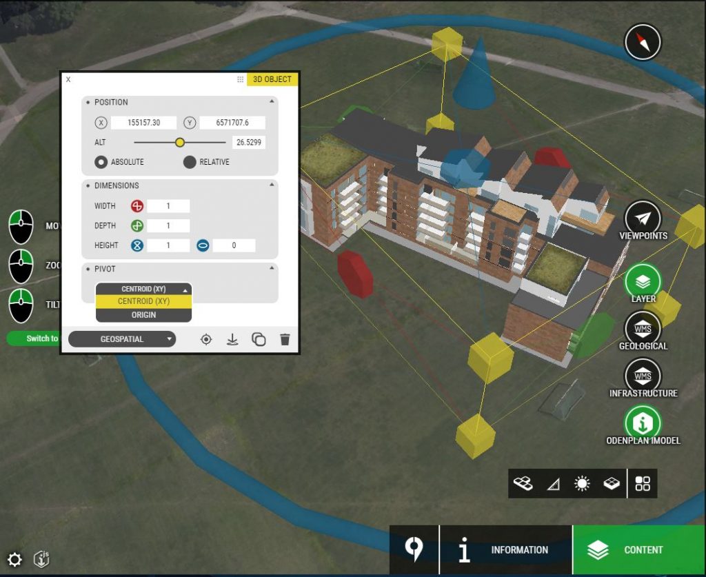
Coordinate center
You can now change the coordinate center of your uploaded 3D model. By default, OpenCities Planner recalculates the coordinate center to the center of the geometry. But in case you have used relative georeferencing, and not explicit in the defined epsg (for instance, you have positioned all your models relative to a known position like a landmark in the city), then you might want to change to Origin and enter your coordinates manually.
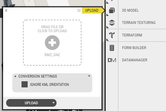
KML orientation setting
For certain versions of Sketchup, the orientation in the KML file within the KMZ file, is incorrect. This can cause the orientation to be applied twice. If you experience this issue, you can now select to ignore the orientation in the KML file when you upload your 3D-model.
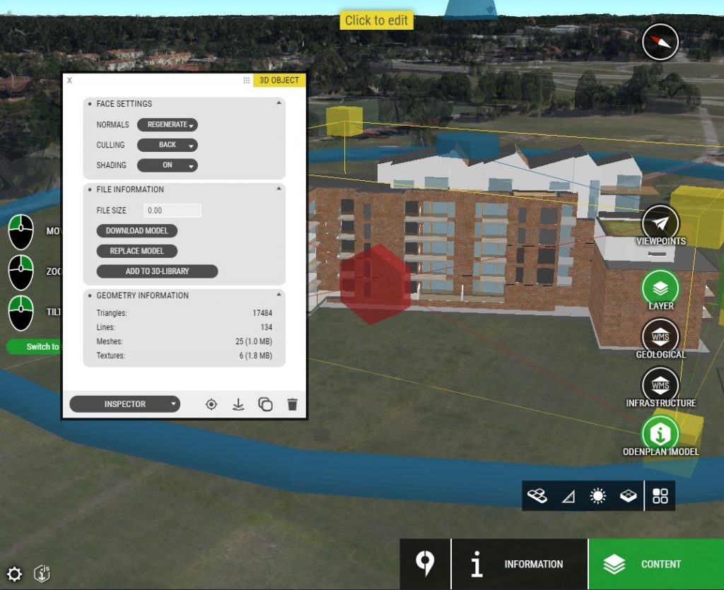
Geometry statistics
The Inspector page has been improved to show geometry information and memory use of your 3D-model. If you’re model is performing poorly, you can have a look and see if it’s very high in geometry count or memory use.