Configure Bing maps for your coordinate system
To configure Bing maps for your projection, go to DataManager and click the Create Map Dataset button. You can also access that by clicking Map Dataset on the right-sided menu and hitting the plus icon New Map Dataset in the top left corner of the new window.
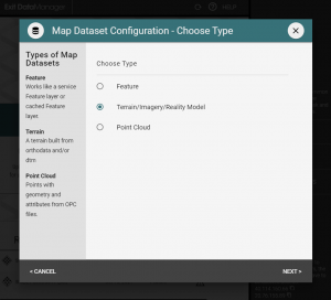
Choose type by selecting Terrain/Imagery/Reality Model and hit Next.
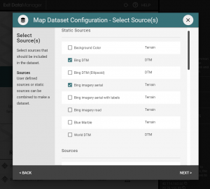
Next, specify your Sources by picking the Bing DTM and the Bing imagery layer that you want. You can choose from aerial, or aerial with labels, or the map version of Bing maps.
Click Next.
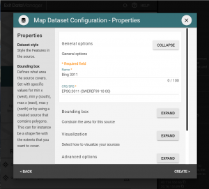
In the next screen, enter a name and type in your EPSG code in the General options.
Here you can also choose to constrain the area of Bing maps to a subset. Expand the Bounding box tab, enter the coordinates in the SRS you’re configuring for or leave empty to get a default bounding box. Configure the LOD Window setting to control the quality by expanding the Visualization tab.
Then hit Create.
That’s it! Now you can use your Dataset in the editor by picking it from Map Datasets.