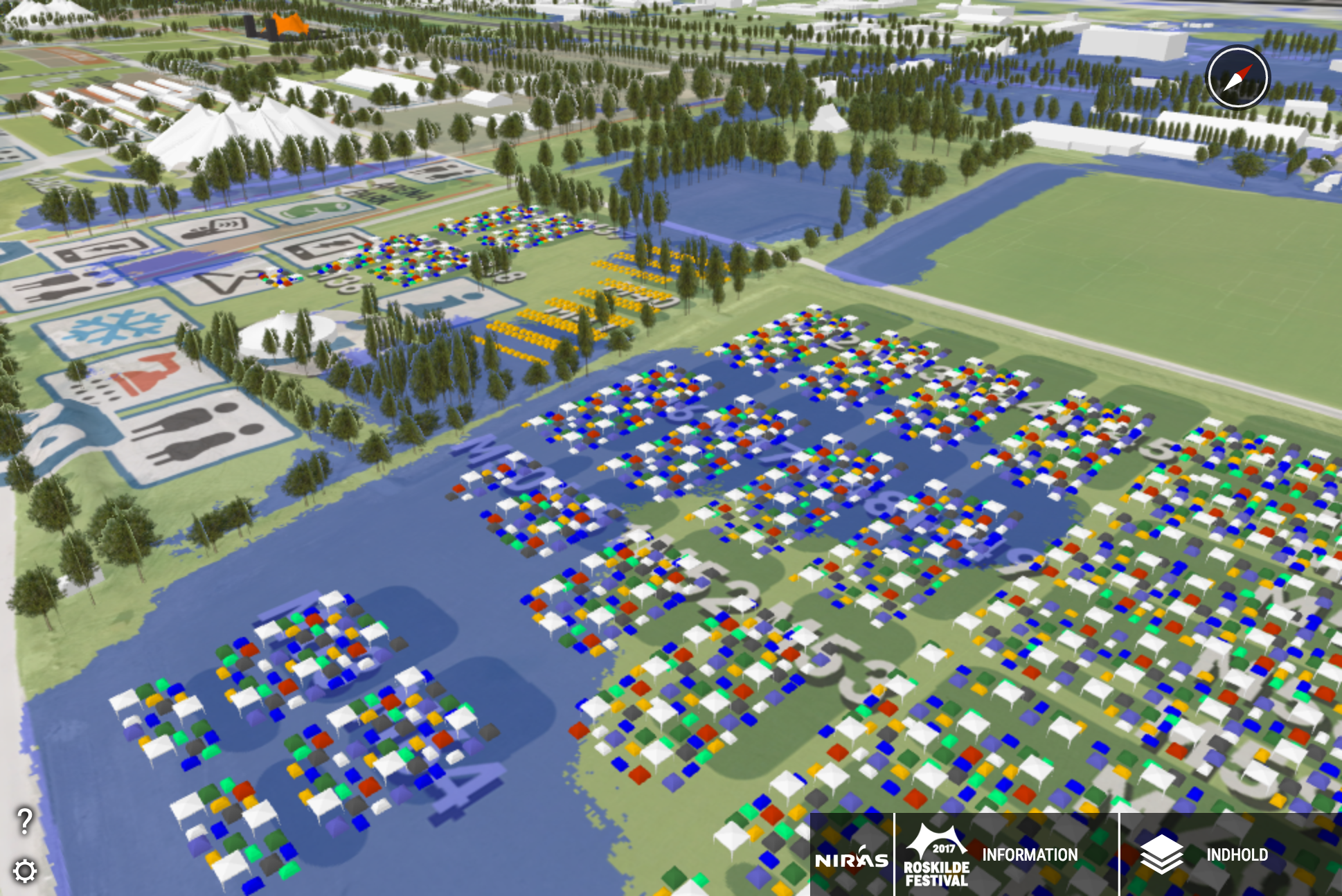
Showcase: Roskilde Festival
Setting Up the Project
To create the Mud Map, several core OpenCities Planner features were used. Let us explore…
- 3D Models – The tents, stages, trees, and festival infrastructure were all added as simple 3D models
- WMS Layer – For putting the mud into the Mud Map, a WMS service was configured to indicate flooding areas in blue
- WMS Layer – You might think the 2D map of the festival was an XL Terrain Image draped over the 3D terrain, but this was also set up using WMS
- Points of Interest (label only) – Used for indicating the various venues and tent areas
Success Story
The Roskilde Mud Map was a huge success, generating over 8,200 page views before and during the festival which ran from June 30th to the 7th of July.
The average visitor was using OpenCities Planner for nearly 3 minutes. Not only did thousands of users visit, but they were very engaged (and presumably dry).
Links
- Visit the published project on cityplanneronline.com
- Learn more about Roskilde Festival
- Niras is Agency9’s partner in Denmark. If you’d like to read more about the project in Danish, please visit their website.
