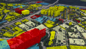
OpenCities Planner extends its data support and is now is capable of rendering data in realtime, from any spatial database.
3D geometries can be streamed directly from your database ie Oracle Spatial, PostGIS or other, caching the data secure the performance. Another example is 3D zoning volumes generated dynamically from 2D zoning polygons and attribute data for height and category to mark colours. This can be combined with 3D Mesh City Model, eg. ContextCapture, Agisoft, Streetfactory, nFrames, and so on.

Contact us at info@cityplanneronline.com for more information.