Bounding Box
A bounding box is an advanced feature you can use while configuring a Source or a Map Dataset. It defines the boundaries of the area covered in the Source/Map Dataset. Everything outside of the defined bounding box will not be displayed. There are 2 ways to set a bounding box:
- Select a pre-configured source that has the necessary bounds
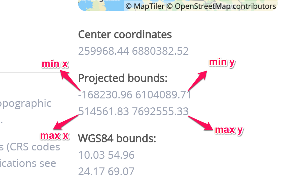
- Define the bounds by setting the specific values for min x (west), min y (south), max x (east), max y (north). You can find the coordinates for your EPSG on epsg.io/(value of EPSG, like 3857). In the Projected bounds, copy the values for min x, min y, max x and max y to the correct field in DataManager.
Note! Make sure that the min value is always lower than the max value.