We’ve recently added a new “2D Mode”. What is it? How do you enable it? Here are the basics.
We’ve recently added a new “2D Mode”. What is it? How do you enable it? Here are the basics.
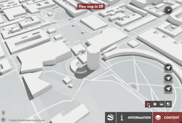
2D Mode is simply what we call the simulated flat map with a top down perspective. We’ve added this mode because it can be preferable to “flatten the map” for certain use cases.
Here’s how it works: You can choose to have a 2D/3D Toggle Button appear in the Toolbar, or lock your project in either 2D or 3D – foregoing the button entirely. Furthermore, you can configure each mode as follows:
There are two windows you need to manage in order to enable and configure 2D/3D Toggle.
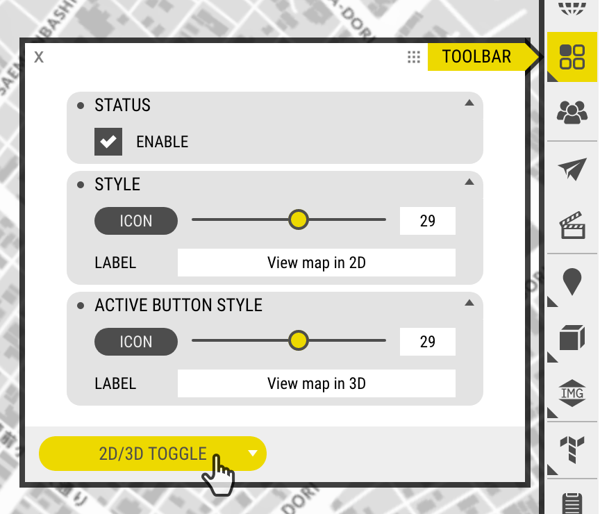
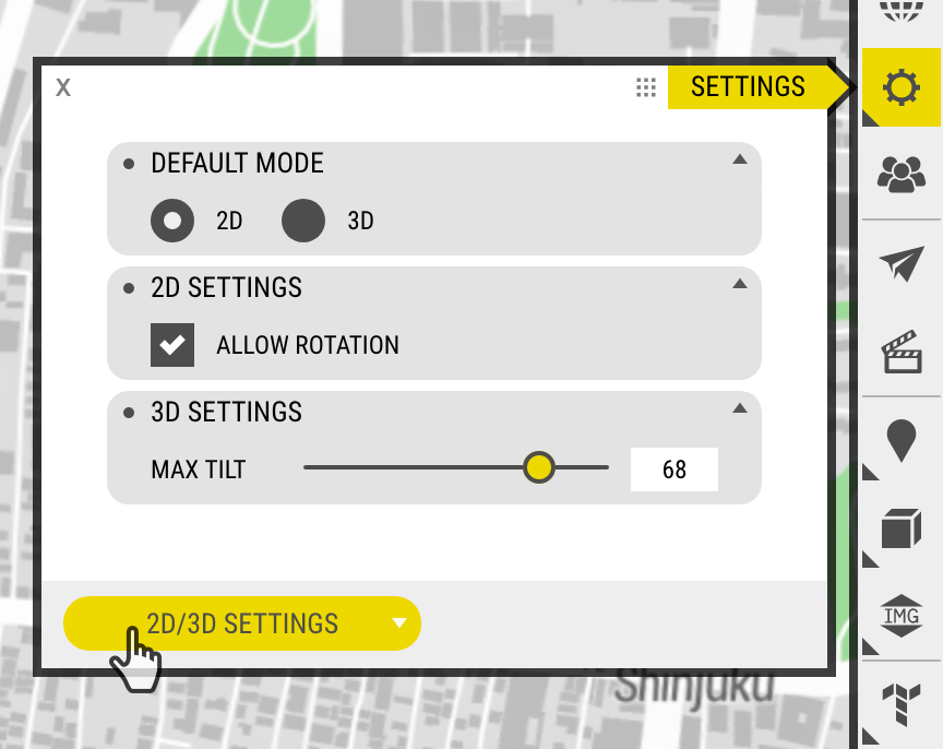
It’s really quite simple, there are only a few settings but they can be combined in different ways allowing you to craft the user experience your project requires.
Log in and test it out yourself, or simply check out this demo: OpenCities Planner 2D Demo.
As always, feedback is more than welcome.
There are more things in Heaven and Earth, OpenCities Planner User, than are dreamt of in your settings
– William Shakespeare, probably