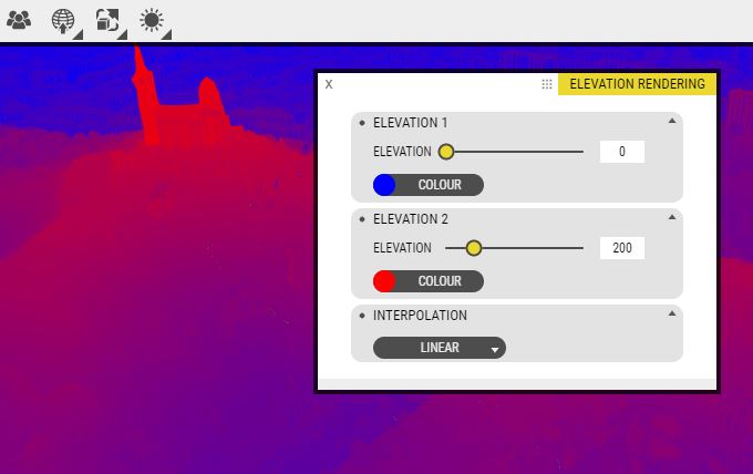
The Elevation rendering tool lets you draw the height data of the terrain as a heat map based on the color values you select. The colors are interpolated between the two color values and the height values that you set. If you wish to see a distinct break line for a specific altitude, you can set the lower and upper limit to the same value.