New Features
The ‘Details’ tab has been renamed ‘On Click’ – with oodles of new options added
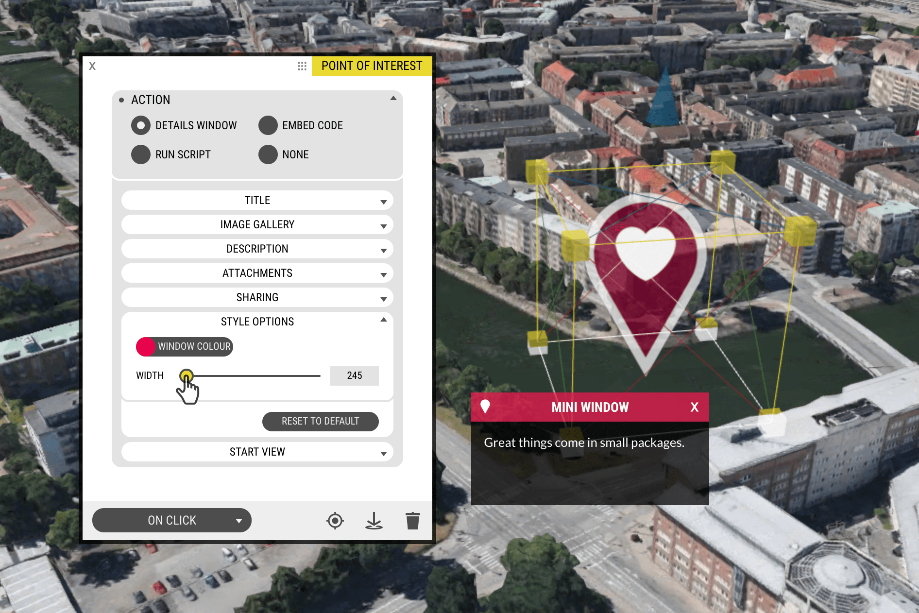
You can now do so much more than simply open a Details Window when clicking a Point of Interest, so we renamed the entire tab On Click.
What happens when you click? You can now choose from 4 options:
- Details Window – The classic OpenCities Planner style window, with added options for setting a custom window width.
- Embed Code – Major improvement from the beta version, now you can edit the window width as well as the title bar text and colour in order to best serve your embedded content, be it a website or video.
- Run Script – If you can write custom javascript, a world of possibilities await.
- None – With this option, you can use “POIs” without an attached window or action. Potential use cases including using them as labels or map indicators. The cursor will not change to a pointer on hover, so the user understands they are non-clickable.
Furthermore, the above Window options allow you to set a custom Start View. This can allow you, for example, to forego Viewpoints and attach camera positions directly to markers.
Clickable 3D Models
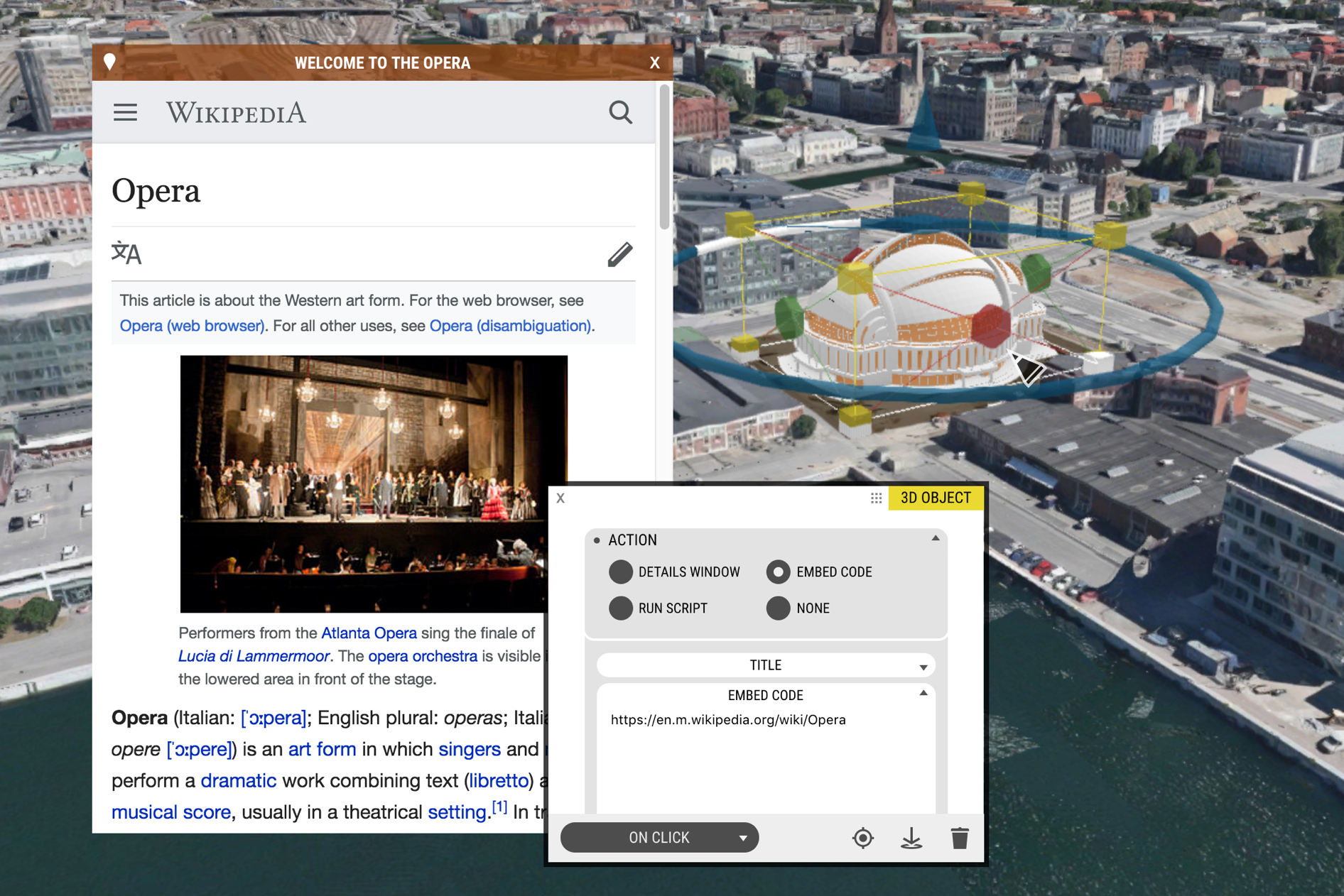
3D Models are now clickable, just like their POI comrades. The default setting is ‘none’, but you can choose to add a Details Window, Embed Code, or even Run Script simply by clicking a model directly.
The cursor will change to a pointer and a tooltip will appear at the top centre of the screen, to inform the user of the object’s clickablity.
Clickable 3D Buildings Layer
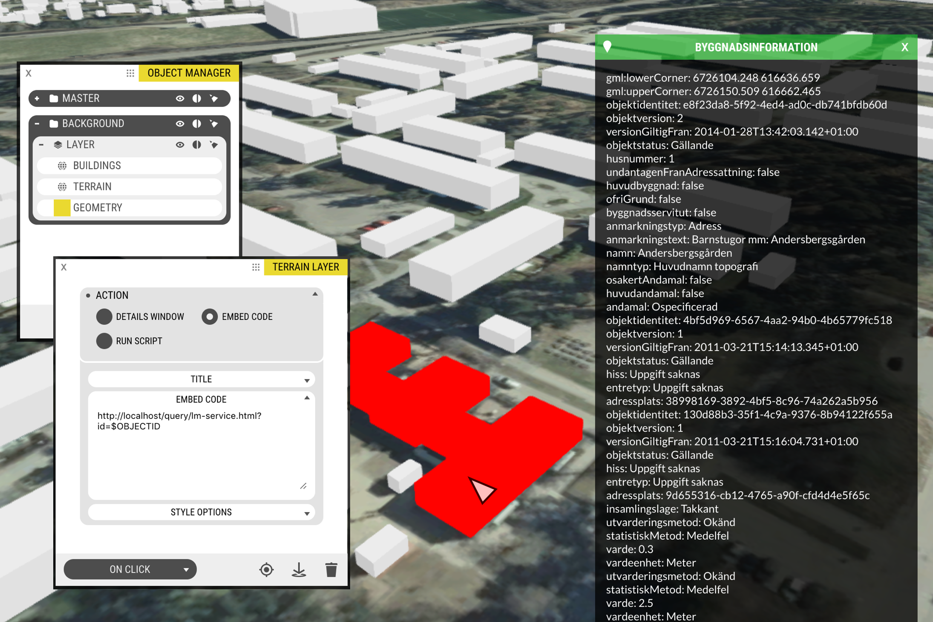
The new On Click tab is also available for Building Layer objects.
You can access the ID of a clicked building using the variable $OBJECTID. An example use case is to query building information from a REST service. In this case, the National Surveying Agency’s information service using the UUID.
Clickable Shape
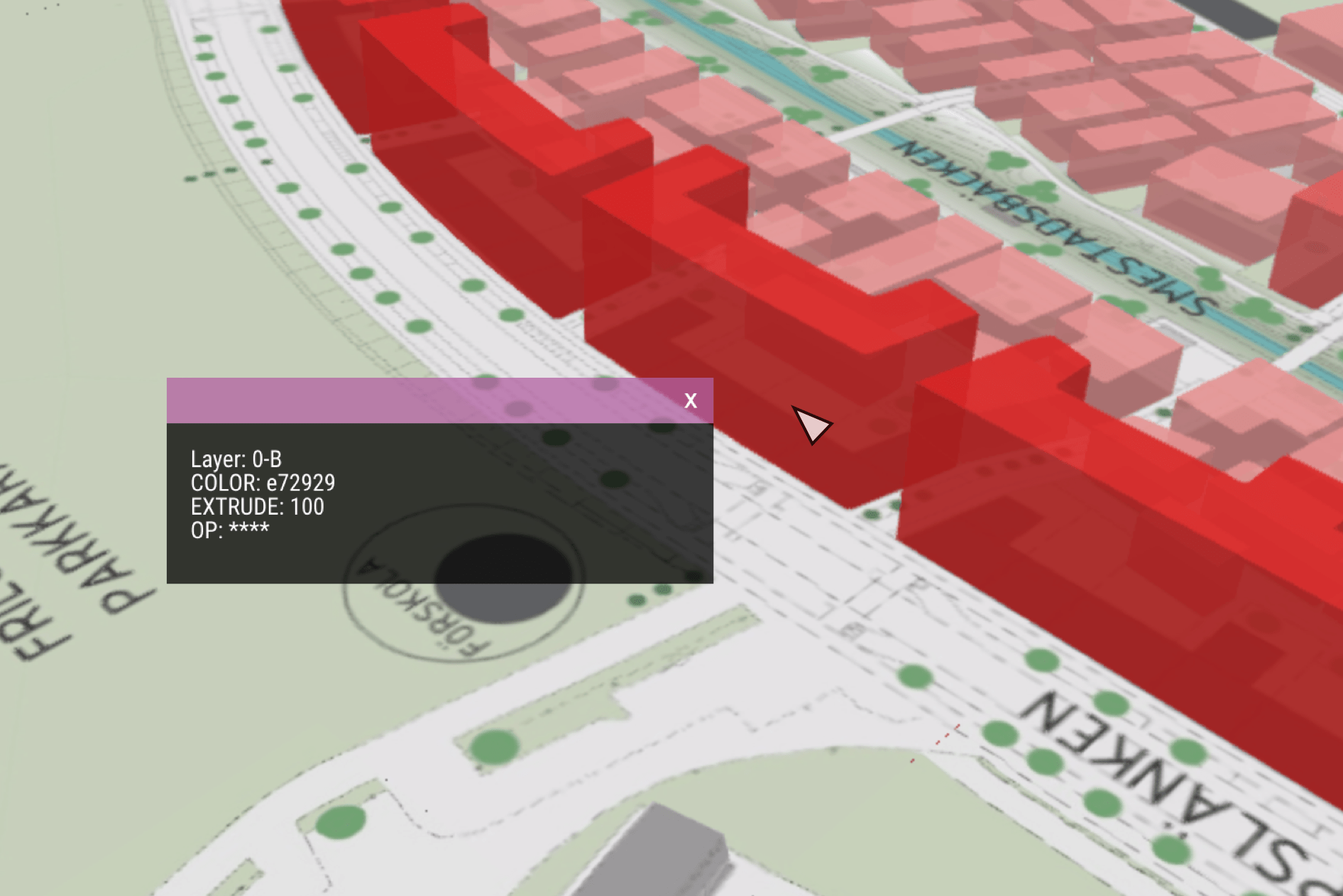
Shapefiles can also have a custom On Click action configured in their Properties window. You can choose to show the attributes connected to the clicked vector element or show a webpage from an attribute in the shapefile. Open the Feature Info tab to turn it on.
Project Save History – Revert to a save point
If you accidentally broke something in your project, you can now go back to a previous save point.
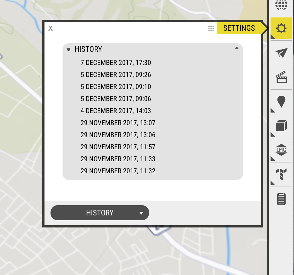
This feature is in beta. For now you can open Settings, where you will find a new tab called History. This will show a list of save points. Click to restore to a previous state.
Improvements
- The Blog link in the Top Bar of the Editor now shows an unread posts notification, so you won’t miss the latest OpenCities Planner news.
- OpenCities Planner API – hideLayer and hideGroup added.
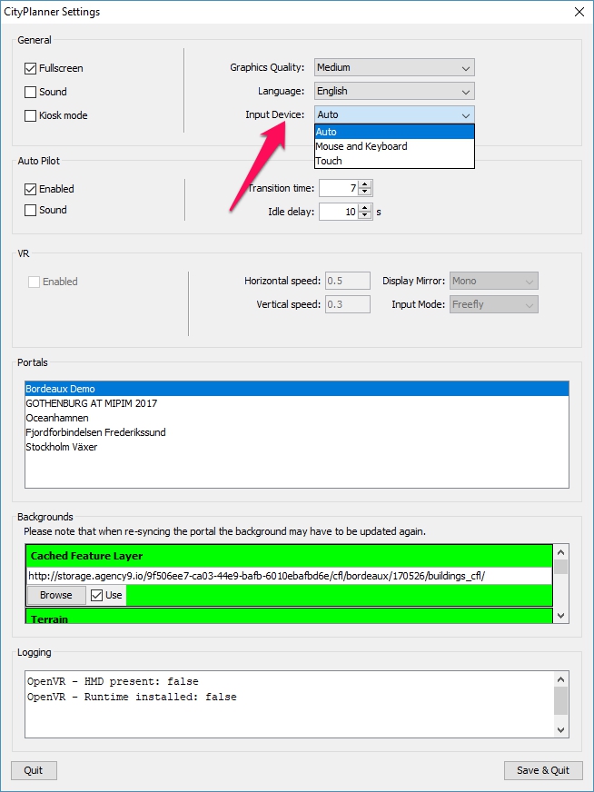
- Offline can be set to only accept Touch input. This solves an issue where some hardware is reporting false mouse events, which can cause Touch input to stop working. Open settings and manually select ‘Touch’ if you experience this problem.
Notable Bugs
- Allow only one active layer/group setting ignored by Offline.
- Measure Tool not showing current altitude under the cursor.